Friday, December 27, 2013

Year End Update


Sara and I just received an email from a fellow hiker who shared a couple days with us just before reaching Steamboat Springs during our CDT trek in July.  Hearing from Dave and seeing some of his pictures reminded us of just how special our hike was this summer.  We can't wait to get back on the trail, but before we do, here's what we've been up to since we got back to Flagstaff.
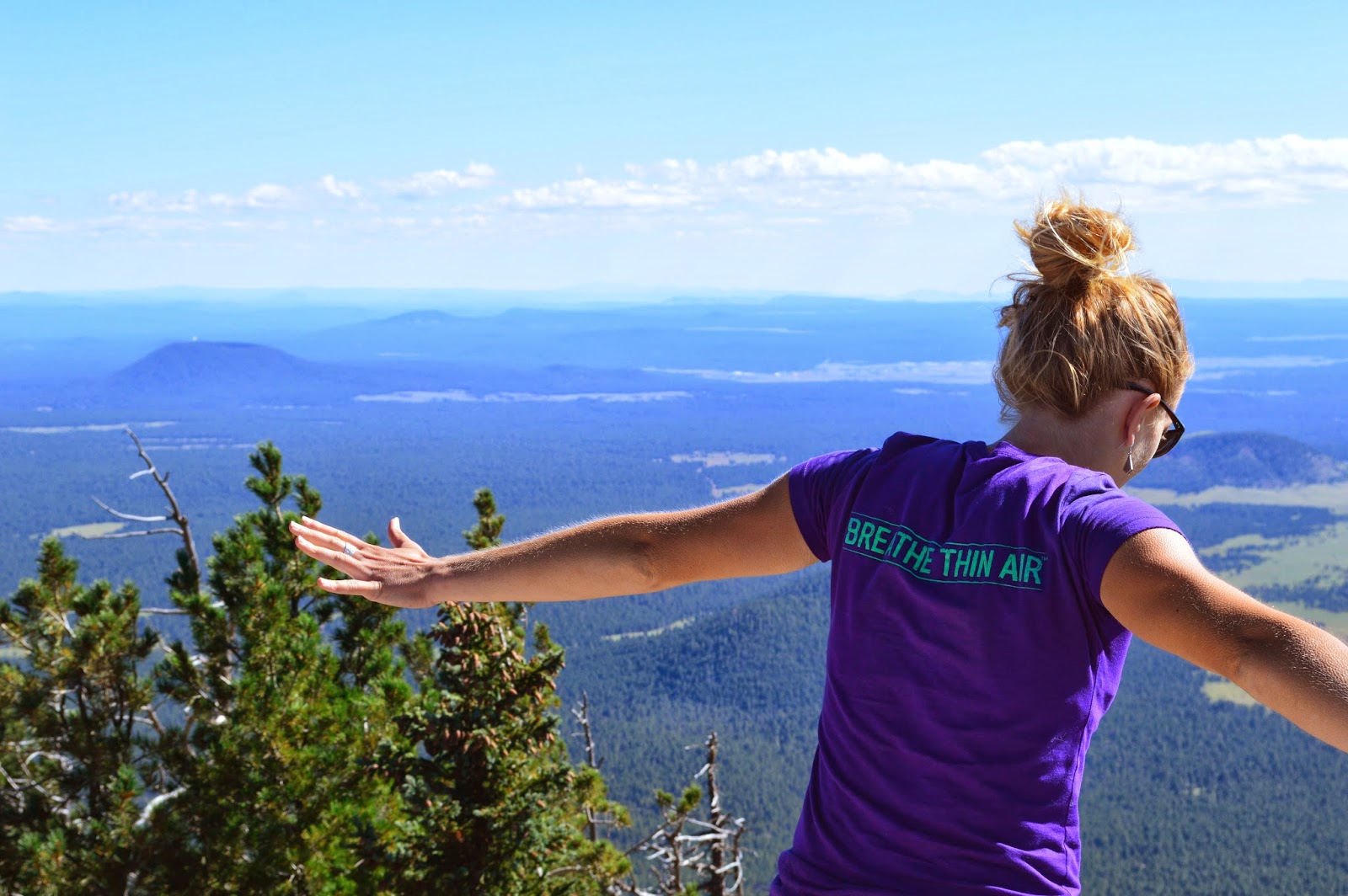
Top of Humphrey's
Sara just survived her first attempt at teaching as a long-term substitute teacher in a middle school English class.  The first couple of weeks were pretty rough, but it seemed like she was able to get a modicum of control by the end of the job.  She was reminded daily how difficult middle school can be between the strains of cold/flu/bronchitis and raging hormones flying down the hallways.
Sara at the top of Kendrick Peak

After her last day in the classroom, Sara got one day off then started working at the Flagstaff Nordic Center again.  We had one medium sized snowstorm (yay!) that allowed it to open, but this will probably be the last weekend until we get some more precipitation.

I helped coach cross country at Flagstaff High School again this fall.  The boys had a rebuilding year, but still made the State meet, while the girls won their 3rd State Championship in a row with an incredibly low score of 34 points.  As excited as I was to get back to coaching, I decided this would be my last season coaching here in Flagstaff.  There may be more coaching in the future, but it will have to be when the stress from other coaches does not infringe on the benefits of working with the runners.

Working at Run Flagstaff has gone really well this fall.  We have had a very busy year and have started putting on a few more events.  Vince (the owner) has let us run with a few event ideas to get more people in the store, and the first couple were overwhelming successes.  Nick (fellow manager) suggested a potluck/discount night for Team Run Flagstaff, which filled the store with great food, lots of people, and exposed us to chocolate chip bacon bit cookies.  If you have never had these, stop reading, and go make some.  It will change your life.


Full store for Cops and Robbers
In mid-December I put on a Cops and Robbers Run through downtown Flagstaff, that also went surprisingly well.  I borrowed the idea from the Footzone in Bend, OR and tweaked it to involve other local business.  Basically the robbers had to run to a few different downtown stores, run in and grab a sticker, and the whole time avoid the Run Flagstaff Police.  One of the police officers is the current US Marathon Champion, so that put everyone in sprint mode.  I was hoping for 30-40 people and we ended up with just over 70.  Most important, everyone had fun and nobody got hit by a car or slipped on ice.
Robbers leaving Peace Surplus during the Cops and Robbers Run

Gavin finished his PCT hike and meandered back to Flagstaff for a few weeks, but then left us again.  He moved up to Bend to live with his girlfriend, Amy, although we think his move is also influenced by the volume of pubs and mountains in the Bend area.  He wasn't able to come back for Thanksgiving or Christmas, but Sara and I will get to go visit him, and Sara's sister, in February.

Sara and I have also decided to do the Mt Taylor Quadrathlon again this year.  After getting over the giardia/heart problems, I started trying to get my fitness back, but had a few lazy weeks.  Sara told me to stop moping about the apartment and to train for the Quad, so I did.  This is the first time I have seriously trained since we started dating.  I started doing running workouts with Vince, mountain biking in Sedona, a road ride here and there, and sneaking in skiing and snowshoeing when we get the moisture.  Sara started getting in pretty decent shape as well, but the diseases the middle school kids gave her set her training back a few weeks.

Soulstice Mountain Trail Run
We both went down to the Phoenix area and ran in the McDowell Mtn Trail Frenzy.  Sara took second in the 5 mile off of very little fitness, and I defended my 10 mile title.  It was a nice little confidence boost for me since my time was four minutes faster than last year and is apparently a course record.  The trail was also super fun, as it was designed for mountain bikes, so we got to swoop up and down the banked turns during the race.

I also got to run down from the rim of the Grand Canyon, down to the Colorado River, and back up for the first time.  I had never run in the Canyon before, and it was amazing.  The weather was gorgeous, and of course the Canyon itself is always spectacular.  It also made me incredibly sore, put me out for a few days to let my legs recover, and has had lingering detrimental effects on my motivation.  I am going back on Monday, however, and this time Sara gets to come with me.  Mt Taylor will seem like nothing compared to the Canyon.

We had an exciting addition to the household in late September.  Sara had been talking about getting another dog for a while, and we finally committed and brought Zeno a friend.  Sequoia is now 7 months old and close to 65 pounds.  Although Sara thinks his head is too small for his body, it's really just his feet that are too big for everything else.  So far he has been pretty mellow as far as puppy's go, but he and Zeno get into the wrestling for hours.  It's been nice to give Zeno company so we don't feel too bad if we don't get him out every day.  

2013 seems to have gone by really quickly.  We shared many adventures, but the highlight for us this year was obviously the Continental Divide Trail.  We, of course, wish we were able to finish it, but are also glad that we made it off the trail safely and were able to regain our health.  At this point we are looking forward to more adventures in 2014 and getting back on trail in early July.

Happy New Year!


Saturday, August 31, 2013

Driving, Driving and some more Driving

On the Oregon coast
After our last post Sara and I went on a road trip to try and get our heads right for a glorious re-entry into society.  After getting a diagnosis of severe over training from the cardiologist, we set off towards Oregon to visit Sara's sister and find my brother on the PCT.  About the time we hit Barstow we got an update on some other tests I did and it turns out I also had giardia. Apparently I had had the lovely bug for almost two months and displayed none of the symptoms, but it did not allow me to recover at night like I should have been, which kept my heart racing, etc.  So we found a Walgreens and Starbucks that night in Sacramento so I could get my metranidazole fix and Sara could get caffeine.

Redwoods
We camped (possibly legally) just north of Redding on some pullout off some road where we could still hear the logging trucks fly by at three in the morning.  Fortunately the ripe blackberries in the morning made up for the few hours of sleep.  That morning, as we realized we left our camera at home, we made it to Crater Lake, the first park on our National Parkish tour.  Like much of the rest of the trip, smoke from forest fires blurred the view, but it was still spectacular.  We did a short hike, my first activity, down to the water's edge where we wimped out on swimming in the chilly water.

From Crater Lake we went up to Bend and stayed with our friend Amy (my girlfriend in-law) in her new apartment.  The next morning we ran along the Deschutes River, where Black Butte Porter flows at 200cfs into the Mirror Pond Pale Ale.  It was a great place for a first run for me, although Amy and Sara tried to hammer me, because it was flat and relatively lower altitude.  More on the Deschutes below.

Our next step was to try and find Gavin (my brother, Amy's boyfriend, Sara's boyfriend in-law) on the Pacific Crest Trail.  We knew he was supposed to be resupplying at Timberline Lodge near Mt. Hood in the next day or so, so our plan was just to hang out until we found him. A few miles before the turn to the lodge the PCT crossed the highway so we slammed on the brakes, pulled into the parking lot and asked another thru-hiker if he knew Gavin.  With over 1,000 hikers on the PCT why wouldn't he know Gavin?  Turns out this guy had been hiking with G-man and Gavin was only 20 minutes back.  Once again the Boughner's impeccable timing strikes.  We were able to spend the night with him along a branch of the Zig-Zag river before he resumed hiking.  It was wonderful to see him in his bearded glory and hear stories from his hike.  Apparently his hike involved many more shenanigans than ours.
Bumpass Hell

After a frustratingly fun two days trying to navigate back to Bend on roads not shown on our Atlas, we arrived at Sara's sister's place.  We had a great visit with Megan as well (where we got our last resupply box from my mom, the camera).  Megan showed us more of downtown Bend and borrowed some inner tubes for us to float on the Deschutes.  The four of us (Amy included again) spent a lazy
hour or so basking in the warm late summer sun of Central Oregon while freezing our butts off in the cold glacier fed river.  Once our feet, butts and hands thawed, Sara and I decided we would really like to have a river flowing through where we live.

Sara and El Capitan, Yosemite
From Bend we made our way to the Oregon coast, with a delicious stop at the Tillamook Factory, where we traveled south.  We spent a morning in the Redwoods, the tallest trees in the world, where we ran into a bear cub during a short run.  We also decided we need to go back and hike more in the park.  That afternoon we ventured to Lassen Volcanic National Park and hiked down to Bumpass Hell (appropriately named for the unfortunate Mr. Bumpass who, while demonstrating the possibility of bringing tourists into the boiling, sulfuric ponds, fell in and lost a leg), which was a rotten egg smelling vale full of multicolored rock and volcanicy stuff.  We decided we need to go back and hike more in the park.

That night we drove most of the way to Yosemite.  The latter portion of the drive (11:00pm-2:00am) was through incredibly smoky areas South of Reno, NV where ash was actually falling.  We managed to find another semi-legal pullout on a road on which to camp before venturing to Yosemite that next morning.  In Yosemite we drove through and did all the touristy stuff (saw Half Dome and El Capitan) and reaffirmed we need to go back and hike more of the park. 

In a Sequoia
Our next stop was at the southern end of Sequoia and Kings Canyon National Parks with Sara's good friend Brie.  Brie is working in the park and so was able to give us an insiders view to the park.  We went for an awesome run in King's Canyon, swam in the King's river, and couldn't go in the cave because of a rock fall. 

We left the National Park tour for a bit and went to the people-infested place that is the Los Angeles megatropolis.  We were able to stay with some of Sara's friends and she showed me some of the great places to eat, and get ice cream.  We also got a tour of the space shuttle Endeavour, which after a multi-day journey through the streets of LA ended up at the Museum of Science.

Tortoise in Joshua Tree
Our last stop of the trip was Joshua Tree National Park.  Here we saw our first desert tortoise, Sara's first tarantula, and a coyote howling.  Neither of us had seen one actually howling.  We went for a short run up Ryan Mountain in the morning then hiked to the 49 Palms Oasis in the middle of a dry canyon.

After that we made our way back to Flagstaff.  Arriving in town this time was much better than a few weeks ago.  Aside from being very ready to get out of the car, both of us feel more ready to get back into the world of society.  I will resume work at Run Flagstaff, which has been very good to us while gone, and Sara will find a job that will tide her over until we resume hiking next summer and continue her commissioned art work.

Thus endeth the road trip.

Wednesday, August 14, 2013

CDT: Part 1, Done.

Getting back on w/ Addie
This is the hardest post to write.  After taking two weeks off in Lander and attempting to get back on the trail, we were forced again to get off after a few days in the Wind Rivers due to my continued elevated pulse.  We have decided to leave the trail for this year and will resume our journey to Canada next summer. 

Our Lander host, Alice Brew, dropped off Sara and our friend Addie and me at the trail head after it seemed I had recovered.  We made decent time and thought all was great as we passed the spot where we had to turn around two weeks earlier.  As we entered the trees (finally, trees!) and started to climb, however, my heart rate shot up.  The slightest incline shot it over 140.  We managed the rest of the day and after passing signs to watch for grizzlies tearing apart a previously buried carcass we camped in a beautiful meadow. 

Beaver dam flooded this bridge
I had hoped that my heart rate was high due to just being out of shape from being off trail for so long, since we both had extra aches and pains, but by the afternoon of the second day it was clear that things were not normal.  The scenery was beautiful though.  It was great to get back into the mountains and camped on an unnamed lake at the base of a huge craggy mountain face. 

The next day we had lunch on a lake at the base of Temple and East Temple mountains before heading over the pass to Temple Lake.  Here, we saw the remnants of a glacier; a stark reminder that our world is changing.  The valley down to Big Sandy lake was gorgeous.  East Temple Peak provided a 2,000' backdrop as we lake hopped down the sheer glacial valley.  It took us all day to do 8 miles since we frequently stopped to allow my heart rate to drop back below 100.  It was not a bad place to need to stop though.  We could spend weeks in that valley.

Lunch spot
Temple Lake
After camping in the Big Sandy area we got out to the Big Sandy trailhead and managed to find a ride.  We were hoping to get a ride at least close to Lander, but the guy was heading to Salt Lake and for some reason went through Pinedale.  If you look at a map you will see that Pinedale is not at all on the way to Salt Lake, much less Lander.  We ended up renting a car so we could drive up to Brooks Lake and retrieve Addie's car.  Turns out we would have been forced around the Winds anyway due to fires that broke out in front of us.  Timing is everything. 

After driving back through the smoke-hazy Tetons, we took a few days to get back to Flagstaff and managed to see one of my old friends in the Rifle, CO area (Ryan Glassman) before staying with one of Addie's friends in Aspen.  We then drove over Independence Pass, had an awesome lunch in Salida (totally recommend the bakery/deli there) and camped just south of Durango.  Watching the mountains fly by as we traveled south through Colorado was depressing.  We spent a long time trying to get north through there and it was all undone in a few hours. 

There should be a glacier, instead it is a snowfield.
I managed to get into a doctor on Monday who ruled out heat exhaustion, so we were back to square one.  Since my resting heart rate never got below 78 on the trail those few days (typically in the 40's within minutes of stopping) and still remains in the high 60's, she thinks something else ails me.  She ordered numerous tests and referred me to a cardiologist, so we are still trying to figure things out.  

As we pulled into Flagstaff, both of us really just wanted to turn around and head back north.  Mentally, neither of us are prepared or capable of being home right now.  It was such an abrupt end to our journey for this year that it is hard to comprehend that last week we were still heading north, on foot.  We saw a few friends in town, but that was about all we can handle. As soon as we know what is wrong with me we are getting out of town to try and figure out how to re-enter society. We are hoping a road trip up to see Sara's sister in Bend, OR
and find my brother on the PCT will help.  All-in-all we would much rather be hiking. 

At this point we would like to thank everyone who supported and followed us through the hike this year.  It would have been much more difficult without the help of our friends and families.  We are going to keep occasionally updating the blog with our adventures and will definitely resume the blog with part 2 of our hike July 1, next year. 

Happy Trails!

-Track and Field

Saturday, August 3, 2013

A Hiccup: Held Up and Holed Up in Lander, Wyoming

A watercolor thank you card for Alice
When we left off from our last post, we were getting back on the trail from South Pass, near Lander, WY. Unfortunately, when we got started Forrest wasn't feeling well, and as we hiked the first seven miles his condition escalated. His heart was racing, he was overheating, and he was nauseous. At one point, I looked over at him and he was stumbling along with his eyes closed. By that time, it became quite apparent that we needed to turn around. We hitched a ride back to Lander, and after a visit to a doctor and the hospital he was diagnosed with severe heat exhaustion. His symptoms had been building for a couple of weeks, so his recovery time was going to be lengthy.

We have been back in Lander for almost two weeks now, and Forrest has finally started to feel better. Incredibly, we have family friends here who have given us wonderful company, a place to stay, and food to eat. We could not ask for a better situation during this rough patch.

Forrest on top of Bridger Peak, just past the WY state line
In the Mt. Zirkel Wilderness
The generosity of our family and friends during this time has been remarkable. We have received care packages from our people in Flagstaff (thank you to Addie, Annie, Chloe, Jacque, Tati, and our parents), and hospitality from Alice, Aileen, and Amber. We cannot thank all of you enough for your support.

Needless to say, it has been difficult to be thrown so far off course. For a moment we were not sure that we were going to be able to continue on. We are now far behind our original schedule, and we have deemed ourselves the NOBO Sweep Team. I have experienced some times of great disappointment while waiting for Forrest to get better, but I keep going back to the first piece of advice we were given about this journey: be flexible.

Thankfully, we will be getting back on the trail within the next couple of days. Our good friend Addie will be joining us for this next section, and we cannot wait to visit with her. We are looking forward to finally going through the Winds, and sleeping outside once more. This next section will be taken one step at a time, with hope that Forrest will continue to feel strong.

Next stop, Brooks Lake Lodge.
-Track & Field

Forrest and I as we crossed the Wyoming/Colorado state line

Monday, July 22, 2013

Blaaaaahhhhhh.....

Lander, WY- Day 86, 1626.7miles.  1534 Switchbacks (no switchbacks in the last 200 miles)

From Rawlins to South Pass City (the pass above Lander) was about 120 miles, was all dirt road walking, had approximately three trees, four hills, three rattlesnakes, and two turns in the road.  It was incredibly blah.  We had absolutely no shade except for a telephone pole one day, and our water sources were spread fairly far apart.  The worst part though was being able to see the road for seven to ten miles in advance.  Mentally it was tough.  Our view was this....

Exciting right?  Now imagine blistering sun, rattlesnakes waiting to snack on your ankles, and 30 miles a day of this.  For the entire stretch we would hike the section you see above, come over a small rise and then see the next section....

And the next section...

And this section...


     Ok, so maybe that is a slightly exaggerated, but that is exactly how it felt while hiking.  After the first full day of this and having no shade, we decided we should be proactive about hiking in the heat.  So we got up at 3:30 the next morning (after a thunderstorm kept us awake for half of the 5 potential hours of sleep) and hiked through until noon.  Then during the hottest part of the day we took a long lunch and nap in the shade from a sign before resuming around 2:00pm.  Aside from being exhausted from lack of sleep the miles were much easier that day.  We went through much less water and the heat did not seem as oppressive.  
     The stretch was not entirely miserable, just mostly.  We did see hundreds of antelope.  They were everywhere.  We even started hearing antelope calls as they were barking at us.  We have both seen antelope before, but the sheer volume and proximity of the antelope in this stretch was impressive.  
Still, this stretch was boring enough that I ended up pulling out the Kindle and reading aloud.  I normally do not like taking away from the hike, but since I could go an hour in between glances around and still not miss anything I decided it was OK.  Without Jack Reacher's shenanigans this stretch would have been even worse.
     The last day we shared the trail with the Oregon Trail for a few miles, which once we made sure we weren't actually headed for Oregon was neat.  It was fun to imagine coming through the same stretch on covered wagons.  We decided we would rather have wagons than walk because at least there would be some shade.  
     Needless to say, when we reached South Pass City and found our boxes and Amber waiting for us it was a great thing.  Just finding a reprieve from the sun was amazing.  We can't wait to get into the Wind Rivers now.  Going from such bleak areas to glaciers is going to be great!  

Amber's dog, Liam.  Much softer and way more fun than rattlesnakes.
-Track and Field

Wednesday, July 17, 2013

Wyoming: The Great Divide Basin, Sea Birds, and a 44

After taking nearly four days off, we left Steamboat Springs and made our way back to where we got off the trail. I was feeling much better after getting started on the right medication for Giardia, and it felt great to be hiking again. Rather than trying to hitch a ride back to the Three Islands Lake area, we found a hiking route out of town that would rejoin us with the CDT after about 25 miles.

Though this added an extra day to this stretch, it was great to see a different part of the Mt. Zirkel Wilderness. We crossed many flowing streams (yes, we treated ALL of our water this time), passed huge granite cliff faces, and meandered through expansive aspen groves. The wildflowers throughout this stretch were spectacular. Indian Paintbrush, Lupine, Sunflowers, and a variety of other colors and aromas surrounded us.

Once we rejoined the CDT, we weren't far from the Wyoming border. Crossing this state line felt momentous, and after a series of trials in Colorado it felt like we were finally making progress. Our maps instructed us to "whoop it up" as we crossed the stateline, and we surely did. After about 15 more miles, the terrain changed drastically. We went from dense forest with many fallen trees to open rolling plains of sage brush, grass, and even some cactus. Our route transitioned from single-track trail to roads, and in a way it almost felt like we were back in New Mexico. By the time we made it to Bridger Pass we had officially made it to the Great Divide Basin. This basin does not allow any water to flow Atlantic or Pacific Oceans. Any rain that falls in the basin remains there, and mostly evaporates.

With a quick inventory of our food and an examination of our bleak water sources, we decided to push our daily mileage and make it to our next resupply point in Rawlins a day early. This involved hiking a 35 mile day followed by a 44 mile day, our highest ever. To be honest, much of these two days now seem like a blur. Highlights include a spectacular sunset, seeing some very misplaced bear prints, and being visited by a seagull and other sea birds during dinner (we were very confused by this at first). Lowlights include biting flies, hot weather, and walking on roads for hours on end. All of the surface water in the last 30 miles of our stretch was alkaline and salty, and hence undrinkable. It was taunting to be hot and thirsty, with only a limited amount of water on our backs, walking by a lake that was practically untouchable.

We made it to Rawlins late, and had trouble finding a motel room. Apparently Rawlins, Wyoming is a very busy place in the summertime. Fortunately, we snagged the last room at the Days Inn, a smoking room. After taking a well-deserved day off our feet, and moving to a non-smoking room, we will get back on the trail tomorrow. The entirety of the next stretch remains in the Great Divide Basin, which ends at our next resupply: South Pass City. Once there, we are looking forward to visiting with our friend Amber who lives in Lander.

Sorry for the absence of pictures. Every time I try to load them the computer crashes. We will try to load some in the next post. Until next time, and further down the trail...

-Field

Tuesday, July 9, 2013

Steamboat x2

Another quick update....

We made it from Rocky Mountain National Park to Steamboat Springs in a few days (saw three bears and a fox, but more to follow) then set off to Rawlins, Wyoming.  After a few days into that section Sara started having severe stomach issues for the second time in a few weeks.  We were able to hitch back to Steamboat and get to a doctor, where we just found out that she has giardia.  We have been here for two nights now and are planning on resuming from Steamboat tomorrow morning with some great medication.  More details to follow!

Monday, July 1, 2013

Brownies and Blowdowns

Jack and Sara
Day 64-1153.2 miles and 1377 switchbacks

Leaving Silverthorne took a while.  Since we were meeting Sara's parents at Grand Lake (just outside Rocky Mountain National Park) there was no benefit to rushing out of there only to get to our next place and wait around.  So we decided to hit up the dollar menu on our way out of town.  Apparently dollar burgers do not help when trying to climb up out of a town to a


Above Lake Ann in the Collegiate Peak Wilderness

pass while carrying fully loaded packs.  We felt rather lazy anyway that day, so we managed seven or so miles then opted to camp just beyond Ptarmigan pass.

The next day we somewhat broke our up-a-pass, down-a-pass pattern and walked along another sweet knife edge ridge.  The random snow drifts along the top made it difficult to hike and look at the elk below us but we made it through.  We reconnected with the official CDT route (apparently took an alternate to get to Silverthorne although both were loosely signed) at Jones Pass and had the privilege of camping below Vasquez Pass where we could hear the monotonous grinding of a huge mine right below us.  Unfortunately a creek drowned out most of the noise otherwise we could have better heard the mining drone, which came from a mine that had torn apart half a mountain.  Ah, progress.
Sara's sister sent us wine

One of the really scary marmots
We set a personal record the next day with 125 switchbacks.  Our previous high was 91 so this was a big day for us.  Whichever trail crew built the section of trail between the top of Flora Peak (just over 13000' and the valley below should do landscaping work because the trail was incredible.  Aside from actually having switchbacks where they should, the crew turned all the rocks in a talus slope to create a flat-ish road for us to walk on.  It was incredible.

Later that day we climbed James Peak, which was just over 1330', and then had an awesome walk on the CDT again.  In case you have not noticed, we enjoy walking on the ridges.  We were able to camp somewhat legally(?) at Rollins Pass at the entrance to Indian Peak Wilderness.  We had a gorgeous sunset, no wind, and woke up to elk grazing outside the tent at sunrise.

Push-ups below Hope Pass
Hiking a sweet ridge edge
Quick pushup update.  Sara is still doing at least sets of 20, sometimes 40, sometimes 64.  I am still in one set, although the last few days have been rather on the difficult side.  We have 65 today, still looming over our heads.  Why did we think this was a good idea?

Our last full day of this stretch we put in some miles.  It helped that we dropped down to a measly 9,000' and had flat, well groomed trail, but we still pushed it.  Late in the day we hit Monarch Lake, which by dem-bones logic is connected to the Granby Lake, which is connected to the Shadow Mountain lake, which is connected to the Grand Lake.  And all of these aquatic appendages are connected to Lake Powell by the Colorado River.  We had the great realization that when we urinate it flows down to where our friends get to guide river trips on it.  Anyway, all these lakes have more water than Arizona.

Climbing the trail
As we were passing through a campground we stopped at the Little Moose Trading Post where Connie (the woman who runs the place) takes awesome care of hikers.  She immediately offered us food and drinks and most importantly, a chair.  Our quick stop turned into gatorade, ice cream sandwiches, muffins, and chips.  We left an hour later armed with three chocolate brownies, which went very well in our pudding that night.

 With only 10 miles to go the next morning we slept in before tackling the blow-downs on Knight Ridge.  The bark beetle has completely ravaged this area so any wind that comes through creates a nightmare for trail crews, fire fighters and hikers being chased by bears.  This section was supposed to be incredibly bad, so I took more weight in the pack since I can steeple chase most fallen logs and this allowed Sara to nimbly pole vault over the worst of them.  In many areas there were three or four trees fallen on top of each other, criss-crossed with the next group.  We ended up going higher up the ridge off trail and found it to not be quite so bad.  Sara had some lovely stomach issues that day so it was good we did not have to go to far.
Sara outside Indian Peaks Wilderness

the Divide from James Peak
We got into Grand Lake just in time to take shelter from a rainstorm that blew through.  Sara's parents met us up here with their new camp trailer and Zeno!  I was worried he would not remember us after so long on the trail but he nearly jumped out the car window trying to get to me.  Definitely made my day to be covered in dog hair again.

At the top of Mt. Elbert
Originally our plan was to day hike a 25 mile loop in the Park today, but a fire on the trail closed that section.  Instead we are just relaxing for today and tomorrow before heading toward Steamboat Springs.  'Tis all for now.

Happy Trails

Track and Field

Monday, June 24, 2013

Billy, Elbert, and Marmotocolypse

What a stretch!  Jack was still with us for 5 of the last 7 days and we covered some up and downs.  We noticed that since we joined the Colorado trail we have been doing less staying on ridgelines and more down a valley, up to a pass, down a valley, up to a pass, etc.  This means lots of hard walking on knees and quads, but also a lot of varied terrain.

From Gunnison we left Monarch Pass and put Jack to the test.  We covered over 18 miles in just over a half day and that was our short one.  He handled it like a champ.  We gave him "monster" status the way he handled climbs.

After going up and over Chalk Pass early in this section, we dropped into a sweet old mining valley.  There was also a For Sale sign on some property just out of a wilderness area that Sara and I already have plans on turning into an adventure base.  We ended up following this old railroad bed up another valley to where a tunnel had collapsed, effectively ending the usage of that line.  The next morning we tried a cross country route to the top of a 13,000' peak, which put us on a sketchy snow-chute traverse then knife edge scree field.  We bailed on the peak and dropped back to Tin Cup Pass.

 After a few more up-downs (we crossed so many Passes this week I have forgotten most of them) we climbed a super steep section to Hope Pass, where I saw my first mountain goat.  Sara calmly informed me that we will see them all over Glacier, but for me it was a big deal.  She wouldn't let me chase it though so I had to settle for a picture.  The goat ended up traversing above us until we set up camp, then laid down and guarded us through the night.

The next morning we dropped to Twin Lakes and crossed a verrrrry (so many R's because my teeth still chatter) cold creek before heading back up to that base of Mt. Elbert.  The CDT in this section winds around the base of this peak, but we decided to go up and over this 14,433' detour.  Why not?  We started climbing at 10,400' and hit treeline around 11,500', then continued to climb another few hours.  It was a big mountain.  It was crazy from the top being able to look down on other 14ers.  Turns out it is the second tallest in the continental US and tallest in the US Rockies.  All down hill from there! 

We dropped off an exhausted Jack (if you know Jack you know that he is never exhausted) at Tennessee Pass then took off on our own.  Yesterday we had lunch at the top of yet another pass with some marmots.  Marmots are normally skittish creatures that look all fuzzy and cute.  These were not.  Sure, at first we thought it was cool they wanted to see what we were doing and eating.  Just curious.  But as they kept edging closer to our food and not running away when I ran at them we decided it was scary.  I am still convinced a previous hiker left rabies filled jelly beans for them.  I even tossed a rock at one, which hit him in the face, to no effect.  What creature does not move when it gets hit in the face with a rock?  We have since decided that pikas are more cute.

Speaking of pikas....we have been doing some survey work for Adventurers and Scientists for Conservation.  This is a group that recruits awesome people like us to take data for them while we are out doing stuff.  We have been doing some pika monitoring so anytime we here a bark or see a small grey flash, we take a gps point.  Check them out if you are planning an adventure.

This afternoon we rolled into Silverthorne, which is pretty close to Copper Mountain and Breckenridge.  No time to ski though, we are off to Rocky Mountain National Park starting tomorrow.  The librarian only gave me so much time so I will try and put up pictures from there.  Use your imaginations for this one.

Happy Trails.

Track and Field

Monday, June 17, 2013

Mountains of Mountains

Day 51, Monarch Pass 928.8 miles, 772 Switchbacks


Colorado is awesome!  We have seen snow, marmots, snow, pikas, and really high peaks.  Going back to before Pagosa (pre-Sara bronchitis), we hiked from Chama into the South San Juan Wilderness and got our first taste of incredible mountainness.  This area was full of craggy, intense bowls that we would hike up, traverse way inside, then traverse back out the other.  Most of the trail in this area tried to stay close to the divide, but since most thru hikers don't have the gear or ability to scale high mountain cliff faces opts to drop into the valleys instead of staying on ridges.  Any north facing slope in this area was covered in multiple feet of snow, which may, or may not, support weight.  Post holing was common, especially late in the afternoon as the snow melted.  At this point Sara started feeling pretty sickly, but we still managed to average just over 20 miles a day.  This might have put her over the edge, however, as we ended up taking two zero days, three nights, in Pagosa Springs to let her heal.
Marmot photoshoot

A fun part of this trip for us is seeing other places we may want to live in the future.  We have been discussing the criteria each of us needs for a place to happily live.  Such as jobs and snow, and housing and snow, and education and snow.  Pagosa Springs seemed to fit all of our categories and had a great bakery, thrift store and brand new brewery so it now moved into our top 5 places to live.

After a few days of recovery in Pagosa, which also allowed the snow to melt, we moved into the Weminuche Wilderness.  Although, still in the mountains this area was more big mountains rather than big ridge lines.  Most of the snow on the trail had melted so we were able to make better time that way, but the elevation change about dropped us a few times.  We dropped below 10,000' once.  Exactly once.  Then proceeded to climb 2800 feet the next morning, then 4000 more that same day.  Our campsite choices also were incredible.  On a lake.  At 12000 feet.  Pretty incredible.
Camp at 12,500'

Just north of our camp at Cherokee Lake two days into this stretch we saw our first bear.  With the way the wind was blowing it did not smell us so we got to watch it walk through a big bowl.  Incredibly an elk came out of nowhere and decided to follow the bear.  The bear eventually decided it should not let a puny 600 pound elk follow it so turned around and scared it off.  No joke.  Incredible way to start out a day.

We resupplied in Silverton, which not only allowed us to consume a few plates from an all you can eat buffet then drastically overpay for 8 days of food, but also served as a meeting place for two friends to join us.  Jack (who I ran with in college and have proceeded to do a bunch of painful races with) and Kate (one of Sara's childhood friends and one of my high school teammates who we have proceeded to do a bunch of painful races with) decided to jump on the trail with us at 12500' and crush miles.  It took Sara and I 40+ days to get into shape for this section. Jack and Kate opted to go for broke right off the bat.

Jack and Kate recovering in the yurt
The first day with them we went 22 miles and up to 13200' and ended up camping at some yurt maintained by the Friends of the Colorado Trail.  Awesome campsite!  Unfortunately the extra days made Jack and Kate hurt as much as we did the first month.  We then continued to hike 20 miles a day with big climbs and high altitude.  I think Sara saw this as an opportunity to repay Jack for the epic (brutally uphill), beautiful (scarily exposed), fun (really?) bike ride/lesson last year in Salt Lake.  Jack is one of our friends who just goes.  No matter what the activity or terrain or pace he crushes just about everybody, except for Sara 45 days into a backpack trip hiking up a hill.  It was fun, in a twisted sort of way, for Sara and I to see Jack and Kate go through the same pains and exhaustion that we went through our first weeks of hiking.  Painful feet.  Huge blisters.  Extreme fatigue.  Now we were on the viewing end.  Still, our friends are pretty incredible.  Very few people could jump in on a hike like this at 20 miles a day and survive in good spirits.  Going to bed at 6:30 helps, but they are also Trail Crushers (as we named our future rock band).

Last night we stayed in a cabin maintained by a snowmobile club at Marshall Pass (interestingly named for a Lt. Marshall who found the pass in 1873 while frantically trying to get to a dentist Denver, seriously), which is occupied mostly by mice and rats.  Sleep was rough last night as every time we got comfortable our four legged rodent friends would start nibbling on some crumb or shoelace.  We survived though and hiked the last 10.7 miles to Monarch Pass this morning.  The last few days have been in the trees again, which is still above 11,000', but today we emerged back up on open ridge lines where we could see some glorious upcoming mountains.

Just before Monarch Pass.  Sara chowing down, again.
One of Jack's friends picked us up at Monarch Pass and drove us to his place in Gunnison where we are staying for the night.  Originally the plan was to hike straight through since we had a box at Monarch, but we have had some equipment malfunctions that we needed to address.  Sara's back support in her GoLite pack has failed  twice so we needed another new support.  We also switched shelters in Pagosa from our TarpTent (which apparently does not withstand 50+ mph winds on exposed ridgelines) to a Big Agnes Fly Creek UL 3.  We are very happy with the tent, but the first night with Jack and Kate a part of one of the poles cracked.  Fortunately we were able to use the field splint to keep the tent up, but it was dicey the rest of the section.  Big Agnes' customer service though is absolutely incredible and they mailed us a new pole set and offered to do anything else we needed.  Both the pack support and pole set, however, did not show up to Monarch Pass so we ended up stealing Jack's car and driving from Gunnison to Salida to find them.  Driving is weird.  Not like riding a bike.  We survived though and now have a new pack piece and a solid tent again, which can withstand the wind.  Big Agnes is headquartered in Steamboat Springs, a future resupply of ours, so we are going to stop by and say thanks for being awesome.  Also, since this was the second time that Sara's pack failed we ordered her a ULA pack that will be in Silverthorne when we get there in 7 days.  Both with Pagosa Springs and here we have been really lucky with having people (my mom and Jack respectively) who can get us where we need to go.
Jack and Sara

Our box today contained some bonus snacks from our parents, and we had a box of goodies from Sara's sister.  Mint chocolate covered malt balls are awesome.  We want to thank everyone who has sent us stuff on the trail (trail magic it is apparently called). This includes our parents, Sara B., and Sara's Aunt Karen & Uncle John. It makes the trip that much more wonderful.

Also, since we were on the trail yesterday, we wish a big Happy Father's day to our dads and any other dad reading this. We will be in Silverthorne in about a week, then on to Rocky Mountain National Park around June 29th or 30th.

Happy Trails

Track and Field

Tuesday, June 4, 2013

Pagosa Springs

Quick update from Colorado...

Sara crossing a snow field
Porcupine chose too small of a tree
We had to take a couple days off trail at Wolf Creek Pass to let Sara's plague heal.  We had a beautiful section of hiking between Chama and Wolf Creek Pass with lots of high, high places, windy conditions and epic snow-chute crossings.  Our lowest campsite was 10,747'.  One day we dropped down to a pass at 11,600.'  Sara had picked up a bug at Ghost Ranch we think that kept getting worse.  We took an extra half day at Chama, but that did not kill it.  This last section, trying to hike with a stuffy nose and phlegm filled lungs all above 10,000', did not go to comfortably for her, but we got some good stuff prescribed today and will hopefully be back on the trail in the morning.  We should take just over four days to get to Silverton where we will meet up with our friends Jack and Kate who will join us for a two and one weeks respectively.  Mountains are awesome!

Looking back on the mountains we crossed
 Happy Trails!

-Track and Field